
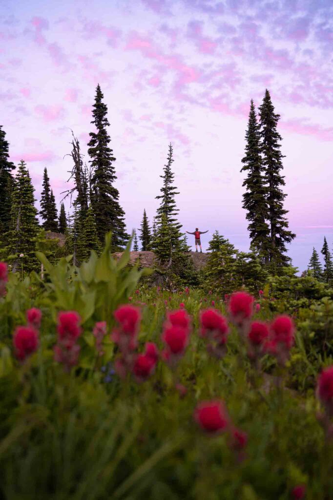
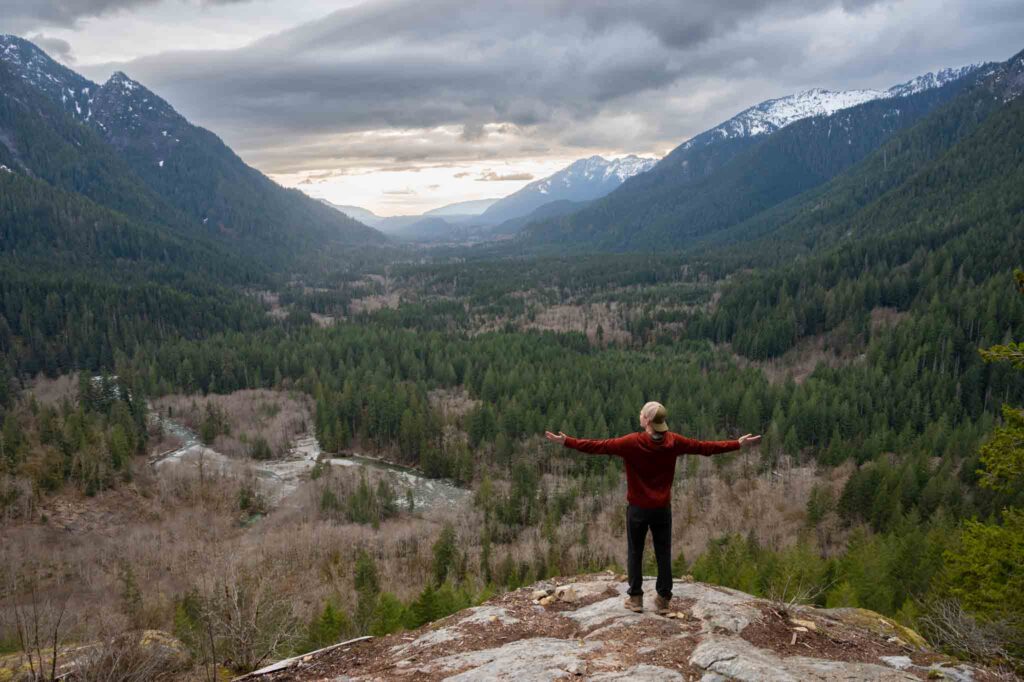
50+ Best Hikes in Washington to Do in Your Lifetime
Calling all PNW nature-lovers: this guide is for you!! Discovering the best hikes in Washington is a lifelong journey. Whether you hike on weekends, in the summer sunshine, or perhaps any chance you get (*raises hand*) I’m happy you are joining me in exploring the Evergreen State on-foot.
Let’s Explore: Best Hikes in Washington
Even after 26 years, the wonder of Washington is not lost on me. Every time I lace up my boots, toss on my backpack, and hit the trails presents a new experience – an opportunity, really.
To be present with my surroundings. To notice the small details. To watch for wildlife. To observe constant change. And, of course, to enjoy quintessential Pacific Northwest views.
In this guide to the best hikes in Washington, I share all of my most loved trails. From time to time it is wise to check back in because this is an ever-growing list!! If you don’t see your favorites, please leave them in the comments!!
Since it is most convenient to access nature close to home, this guide includes botanical gardens and nature preserves within cities. Otherwise, trails are typically part of Washington State Parks, National Parks, or National Forests. By the way, knowing who manages the land you’re visiting is key to being well-prepared!!
For the most part, the following hiking trails in Washington are easy-moderate day hikes that can be family and dog friendly (if dogs are allowed).
Disclaimer: This post may contain affiliate links, which means I may receive a small commission if you purchase through my links (at no extra cost to you). Thanks for your support, and happy adventures!!
2024 Local’s Guide to the Best Hikes in Washington State
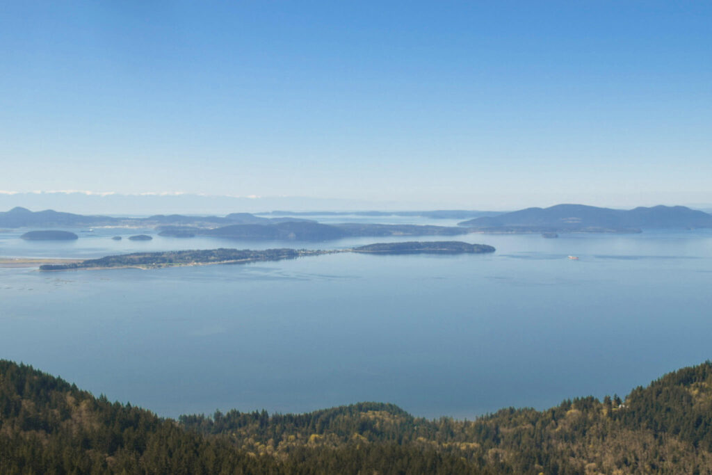
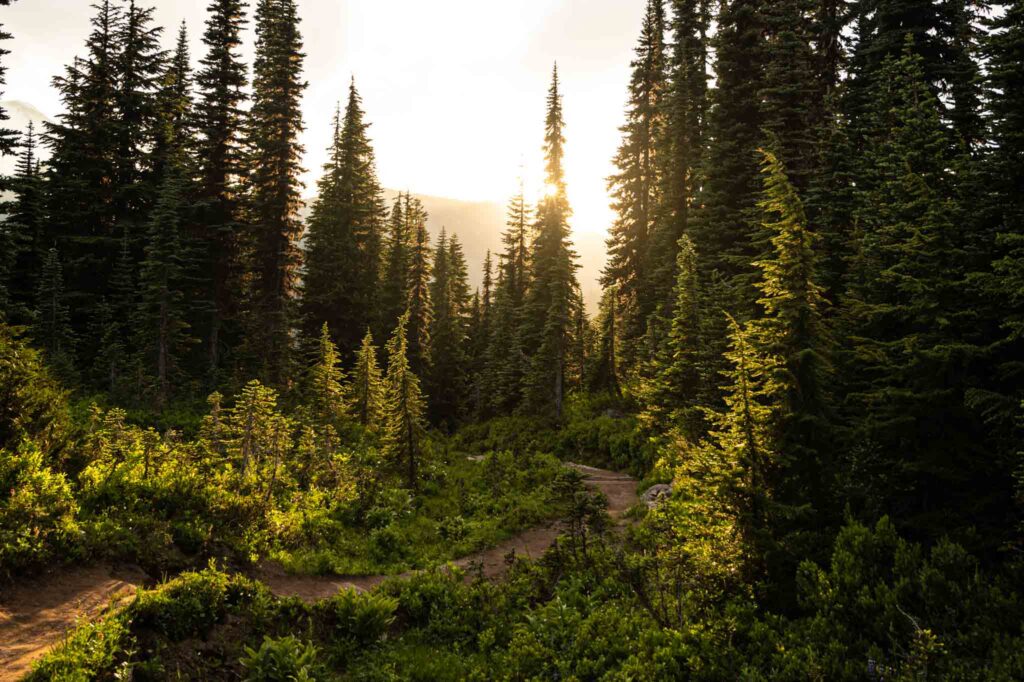
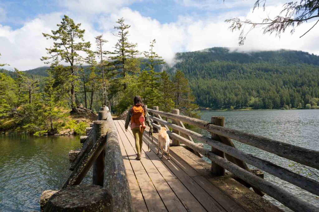
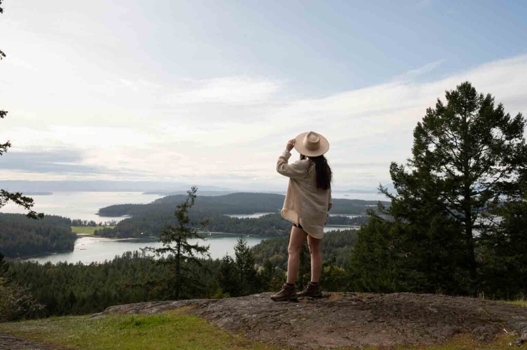
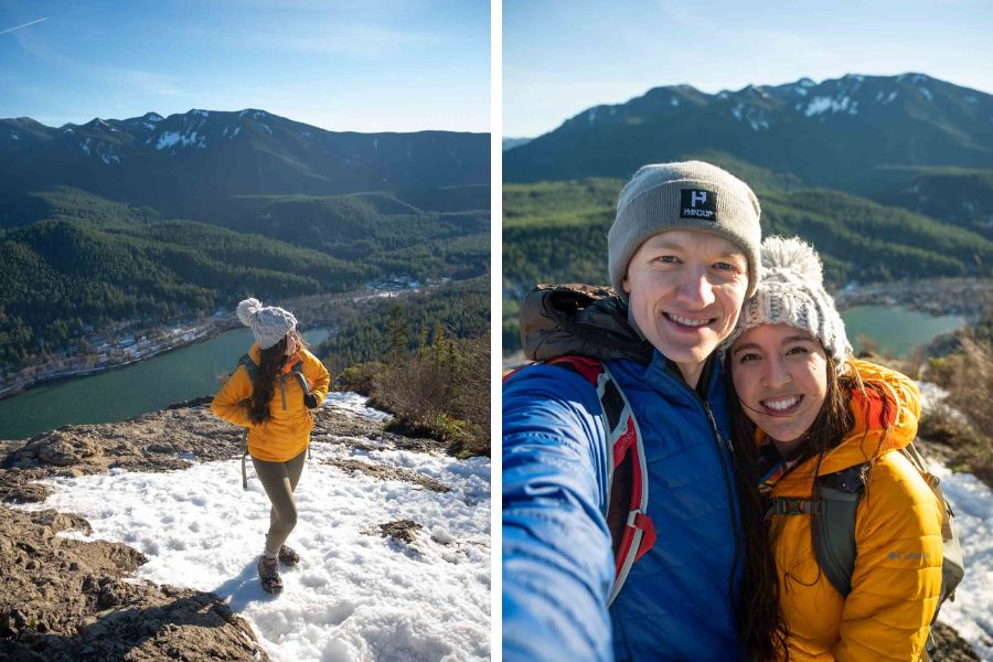
Oyster Dome
– Location: Bellingham
– Nearest City: Bellingham
– Best Time to Hike: Year Round
– Must-Know Notes: Two different trailheads
– Distance: 5 miles, 1,050 ft gain/ or 9.6 miles, 2,050 ft gain
– Required Pass: Discover Pass
A popular hike near Bellingham, and my dog’s accidental longest hike! The first time we hiked Oyster Dome, we did only a little research and began our journey off of Chuckanut Dr. Thinking we were in for a 5 mile round trip day with about 1000 elevation gain, the three of us sure were beat when we finished clocking in double those numbers.
Our mistake was not knowing there are a couple different starting points to this hike. One being off of Chuckanut- which is easier to access and a shorter drive from Bellingham, and the other trailhead is to drive to the top of Samish Overlook- gravel road with a couple rough spots.
The second time we hiked this we chose to start at Samish Overlook, which makes this hike the 5 mile round trip day with less elevation that we expected the first time! Ha!
On this hike, you wind up and through a classic PNW forest and at the final viewpoint you will find yourself standing atop the grand rock face with epic views out across Samish Bay and to the San Juan Islands.
Bestie Tip: Summer sunsets from Samish Overlook are insane! Hike this trail in the evening and be back at the parking lot at sunset to enjoy a fun beverage or post-hike picnic with a view.
Check out our guide of favorite things to do in Bellingham.
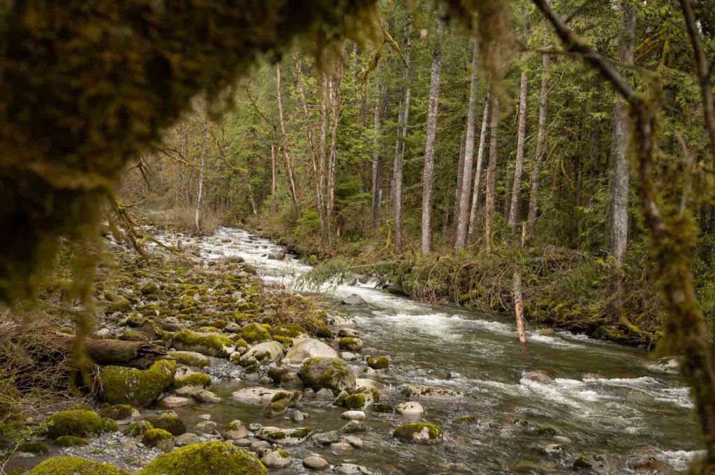
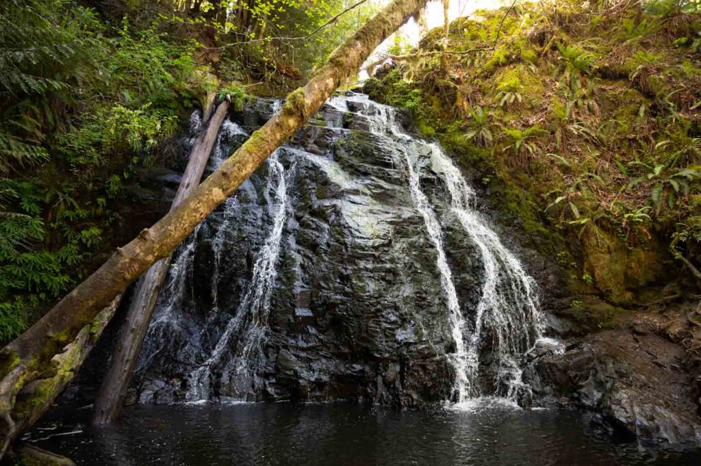
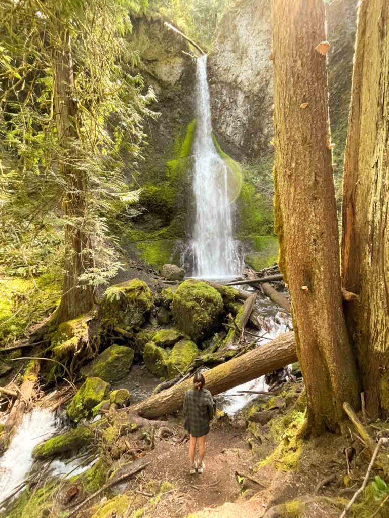
Wallace Falls
– Location: Stevens Pass Highway- Gold Bar
– Nearest City: Monroe
– Best Time to Hike: Year Round
– Distance: 5.6 miles, 1,300 ft gain
– Required Pass: Discover Pass
Did you think you’d have to wait long to see a waterfall hike within this guide of the best hikes in Washington State? (My guess is no!) Wallace Falls State Park is a popular year-round hiking destination. As are with most of Washington’s hikes, this park is busiest in summer months when the sun is out. On weekend afternoons, you may struggle to find parking here!
The trails are pretty well-maintained, and very scenic. The trail leads up the Wallace River under mossy trees and next to cascading water that glows a greenish blue when the sun hits it. Refreshing.
The waterfalls are impressive, and having multiple picturesque waterfalls on one trail makes this State Park totally worth a visit.
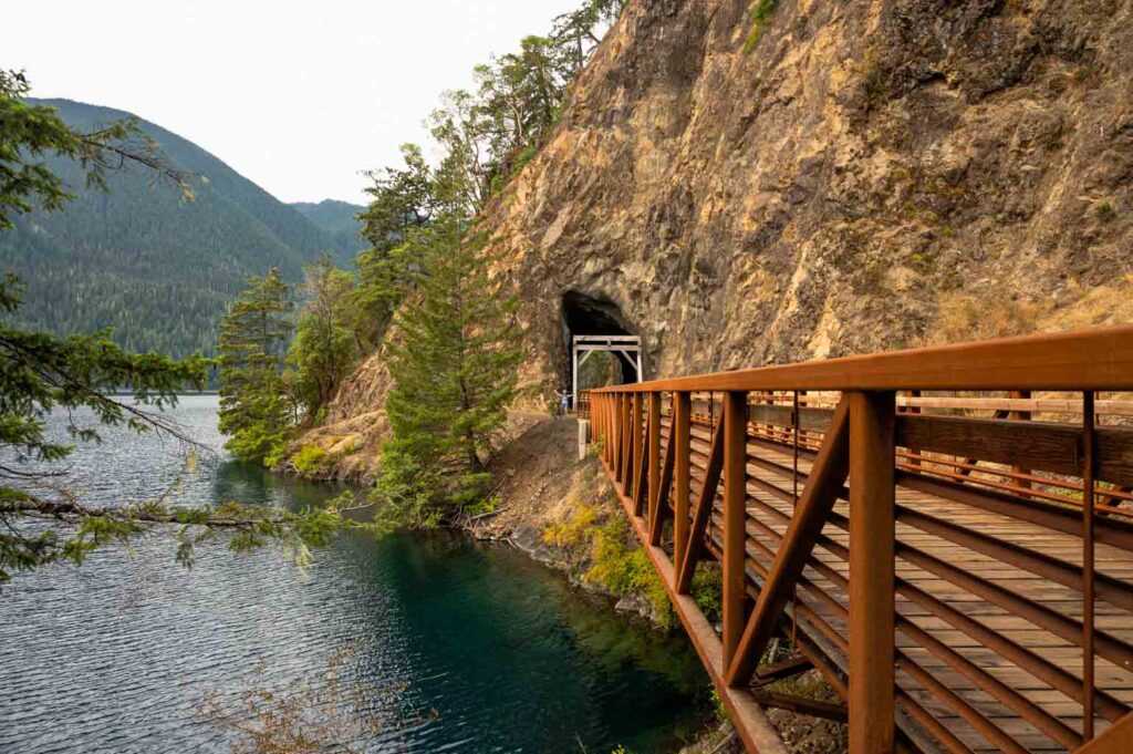
Spruce Railroad Trail – Devil’s Punchbowl
– Location: Olympic National Park – Lake Crescent
– Nearest City: Port Angeles (20 miles)
– Must-Know Notes: Share the trail with bicyclists
– Best Time to Hike: Year Round
– Distance: 2.4 miles, 137 ft gain
– Required Pass: n/a
**As of December 2023, the trail is closed due to a rockslide. Check with the Olympic Discovery Trail for updates.**
Hike on an old railroad grade to a scenic pool of blue. This trail begins at the Camp David trailhead on the north end of Lake Crescent. Hike along the paved path until you reach one of the interesting railroad tunnels along this trail. Then, don’t go in the tunnel, take the dirt path to the left and it will lead you to the picturesque spot with the bridge.
This is a popular destination for kayakers who rent a boat from the lodge across the lake, and for people looking to jump off the surrounding cliffs into the pool. It is no doubt a great photo spot, and for me, a great spot to find a seat along the lakeshore and have a snack.
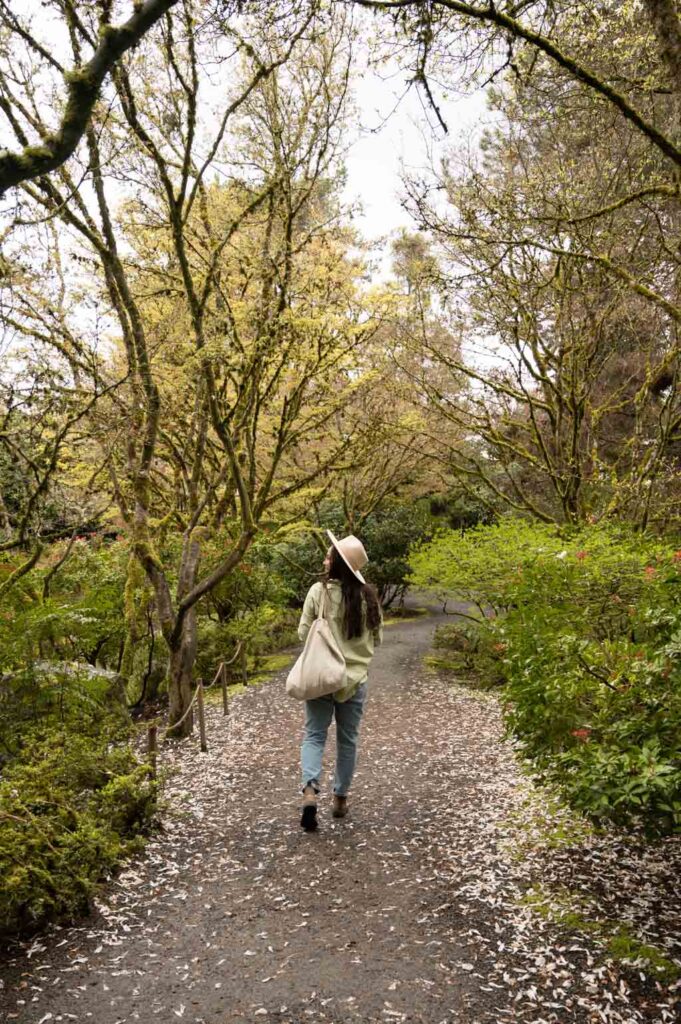
Bellevue Botanical Gardens
– Location: Bellevue
– Nearest City: Bellevue
– Must-Know Notes: Home to the festive Garden D’ Lights display during the holiday season
– Best Time to Hike: Spring
– Distance: Varies by trail (longest is 0.5 mile)
– Required Pass: n/a
You may be surprised at how far you feel from the city while walking through Bellevue Botanical Gardens.
As a public garden, it’s pretty wonderful that the City of Bellevue and its partners have maintained this space free of charge to visitors since 1992.
Whether you seek a short stroll or solitude in the outer forest known as The Woodlands, there’s something for everyone here. (This is one of the most underrated best hikes in Washington).
Before heading out, don’t miss the Shorts House. Here, you’ll find Copper Kettle Coffee Shop and an opportunity to learn about the couple who used to call these gardens home.
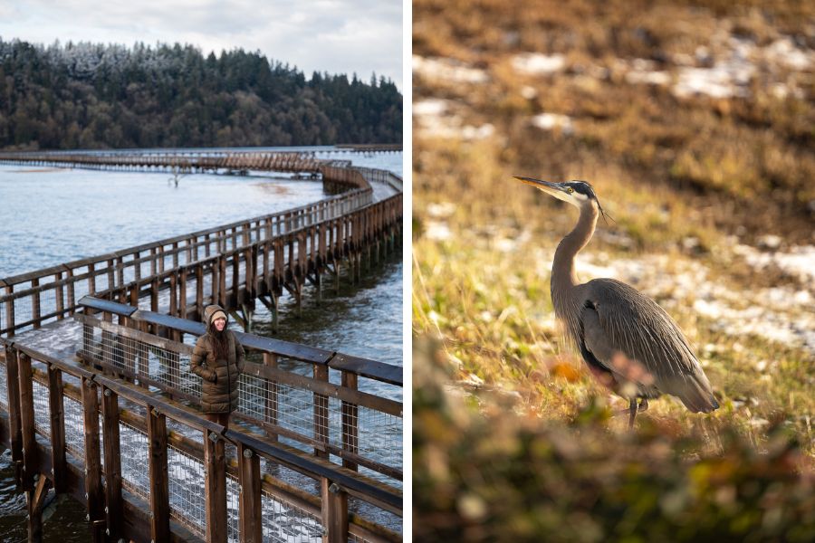
Billy Frank Jr. Nisqually Wildlife Refuge
– Location: Olympia
– Nearest City: Olympia
– Must-Know Notes: Great for birdwatching
– Best Time to Hike: Year Round
– Distance: 4 miles
– Required Pass: America the Beautiful Pass or $3.00
Looking for adventure in the South Sound? Then, see where the terminus of Mt. Rainier’s Nisqually Glacier meets the Puget Sound.
The Nisqually watershed is one-of-a-kind for originating in a National Park and ending in a National Wildlife Refuge. Pretty cool right?! Typically, this trail is underrated. So you won’t find it on many other guides of the best hikes in Washington. (Special thanks to you for reading my guide!!)
Within a landscape of ever-changing tides, you’ll likely spend most of your time trotting over a wooden boardwalk that crosses tideflats. Depending on the season and time of day, you could look down to see either a couple feet of water or, well, mud.
As you may have guessed from its name, what really makes the Nisqually Wildlife Refuge interesting is its wildlife. It’s common to see bald eagles, deer, and harbor seals (amongst many varieties of birds).So, pack the binoculars!
Even on sunny days, expect wind while out on the boardwalk.
Bestie Tip: Link the Twin Barns Loop and estuary boardwalk trail. Don’t miss the educational visitor center and a view of Mt. Rainier from the viewing platform on the far end of the boardwalk.
In case you don’t have an America the Beautiful Pass, the entrance fee is $3.00. This fee covers entrance for 4 adults.
Price Sculpture Forest
– Location: Whidbey Island
– Nearest City: Coupeville
– Best Time to Hike: Year Round
– Distance: 0.6 miles, 100’ gain
– Required Pass: n/a
Surely we can agree that forests are beautiful in their own right. But, have you ever seen an art gallery within a forest?!
Situated on the lovely Whidbey Island, Price Sculpture Forest is a recently-opened park that is free to the public.
A joy for both kids and those who are kids at heart, you’ll enjoy sculptures, paintings, and metal art alongside nature. While exploring the island, use this guide to incredible things to do on Whidbey Island!!
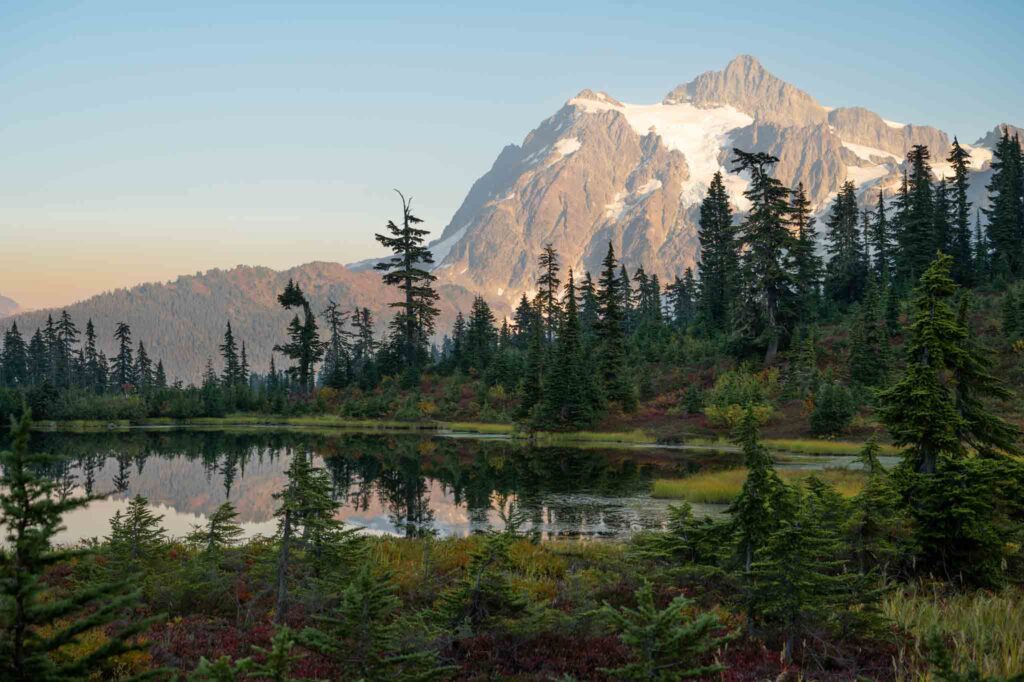
Picture Lake
– Location: Mount-Baker Snoqualmie National Forest
– Nearest City: Bellingham (60 miles)
– Best Time to Hike: Late July to Mid-September
– Distance: 0.4 miles
– Required Pass: National Forest Pass
Full of unbelievably photo-worthy views, Picture Lake is deserving of your Washington State bucket list. For more ideas, check out our complete list of ideas to add to your Washington State bucket list.
With a paved 0.6 mile, ADA-accessible trail around the lake, this trail is for everyone.
Hands down, my favorite time to visit is at sunset.
While in the area, it’s absolutely worth driving the full duration of Mt Baker Scenic Highway up to Artist Point. Here, you can picnic, go for a longer hike, or simply soak in the views. On your way down, swing by Picture Lake as the golden light shines on Mt. Shuksan.
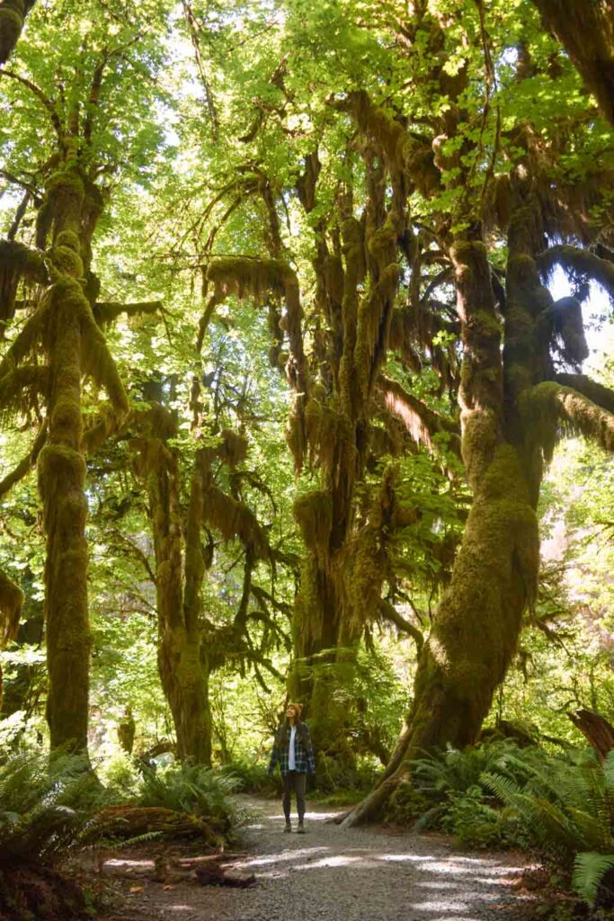
Hall of Mosses
– Location: Olympic National Park
– Nearest City: Forks
– Best Time to Hike: Fall for beautiful foliage & moody Twilight vibes, and Roosevelt Elk
– Distance: 0.8 miles, 100’ elevation gain
– Required Pass: America the Beautiful
When you think of the Pacific Northwest, lush green forests probably come to mind. While there’s no shortage of opportunities to explore forests (especially west of the Cascade Mountains), Olympic National Park’s Hall of Mosses has become an iconic forest experience.
Located within a rainforest, this family friendly trail is short but sweet. Walk slowly, keeping an eye out for moss, lichen, and interesting trees (such as nurse logs). Don’t forget to look up! You’ll walk beneath unbelievably-sized Big Leaf Maple trees.
Since these trees are deciduous, a fall visit can be quite rewarding!!
Ruby Beach
– Location: Olympic National Park
– Nearest City: Forks
– Best Time to Hike: Summer weekdays
– Distance: 0.5 miles +
– Required Pass: America the Beautiful
As one of the most beautiful beaches near Port Angeles, Ruby Beach is a not-so-hidden-gem on the Olympic Peninsula. Although it’s only about a quarter mile descent to the beach, you can explore up to 6 miles of shoreline at low tide.
Without a doubt, dramatic rock formations like Abbey Island and Destruction Island add to the allure. To make the most out of your visit, check tide charts so that you arrive at low tide. This way, you’ll have access to more beach AND the opportunity to go tidepooling! Truly, Ruby Beach is one of the best hikes in Washington for beach lovers.
Since this is a popular place, it’s wise to visit either during the week or outside of July and August. If you, like me, don’t mind bundling up then try an off-season adventure.
Trail of the Shadows Loop
– Location: Mount Rainier National Park
– Nearest City: Ashford
– Best Time to Hike: Winter
– Distance: 0.7 miles
– Required Pass: America the Beautiful
Regardless of when you visit Mt. Rainier National Park, the Trail of the Shadows is a quick hike that’s fun for the whole family. Keep your eyes peeled for trees chewed by beavers and bubbling hot springs. Along the way, take your time reading interpretive signs.
Admittedly, I would not recommend a visit to the park with this as your primary stop. But, if you have some time after checking out Paradise or are visiting during winter, this is worth checking out. Often, the road to Paradise is closed in the winter. These days, snowshoeing the Trail of the Shadows is worth considering.
While there, swing by the Longmire Museum for a trip back in time as well as the Longmire General Store for books and souvenirs.
Little Mountain Park
– Location: Skagit Valley
– Nearest City: Mount Vernon
– Best Time to Hike: Year Round
– Distance: Varies by trail
– Required Pass: America the Beautiful
Although people from around the world visit the Skagit Valley for the world-famous Skagit Valley Tulip Festival, few know about Little Mountain Park.Located a handful of miles away from the fields, those who visit are treated to a birds-eye-view of the valley (including the colorful flower fields) and beyond.
As the largest park in the area, locals love frequent the 12 miles of forested trails on foot or by mountain bike.
Alternatively, you can always drive to the top if you’re running on low time. The road is paved, so 4×4 is not necessary.
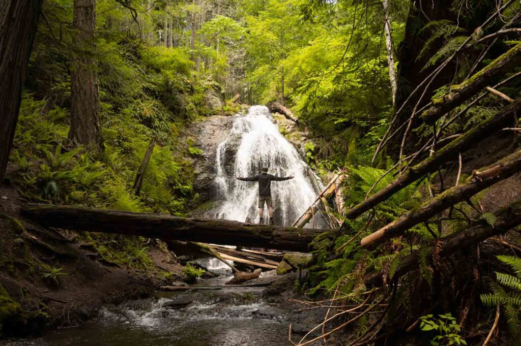
Rustic, Cascade, Cavern, & Hidden Falls
– Location: Orcas Island
– Nearest City: Eastsound
– Best Time to Hike: Year Round
– Distance: 1.2 miles
– Required Pass: Discover Pass
Did you know you can chase waterfalls on an island? Personally, I can’t imagine a more perfect hike in Washington. For that reason, I had to include this on my list of the best hikes in Washington.
With little change in elevation, this peaceful trail is ideal for pups and kids. Given it’s distance, I’d say it’s pretty rewarding!
All 4 waterfalls are located on Cascade Creek within Moran State Park, on Orcas Island.
Cascade Lake Loop
– Location: Orcas Island
– Nearest City: Eastsound
– Best Time to Hike: Year Round
– Distance: 2.6 miles, 278’ elevation gain
– Required Pass: Discover Pass
While on Orcas Island, don’t miss a peaceful lakeside hike in the shadow of Mount Constitution (the highest point in the San Juan Islands).
Cascade Lake Loop winds through lush forests to reveal swimming spots and wildlife including river otters.
Our Labrador Retriever, Lilo, loved this hike!
Dickerson Creek Falls
– Location: Kitsap Peninsula
– Nearest City: Port Orchard
– Best Time to Hike: Year Round
– Distance: 2.3 miles
– Required Pass: n/a
If you’re not local to Bremerton or Port Orchard, then you’ve probably never heard of Dickerson Creek Falls. Situated within the Ueland Tree Farm, this trail (and road) is typically open to the public but is, technically, private property. Be sure to read all signs and be respectful while visiting.
I’ll admit, navigating here can be a little confusing. This is because hikes have the option of trails or a gravel road. So, it’s wise to download or print a map of the area before arriving.
When we visited, the base of the falls was a popular swimming hole for people and pups alike.
Please note that the final ascent is somewhat steep, so use caution.
Overall, the Kitsap Peninsula is full of lots of hidden gems — making this one of the little-known best hikes in Washington. Make the most of your visit by checking out these things to do in Port Orchard.
Christine Falls
– Location: Mount Rainier National Park
– Nearest City: Ashford
– Best Time to Hike: Summer
– Distance: ~0.1 miles
– Required Pass: America the Beautiful
Known as one of the roadside attractions for national park goers en route to Paradise at Mt. Rainier, Christine Falls the few steps down isn’t exactly a hike, but is still worthy of a visit!
Best visited July through September.
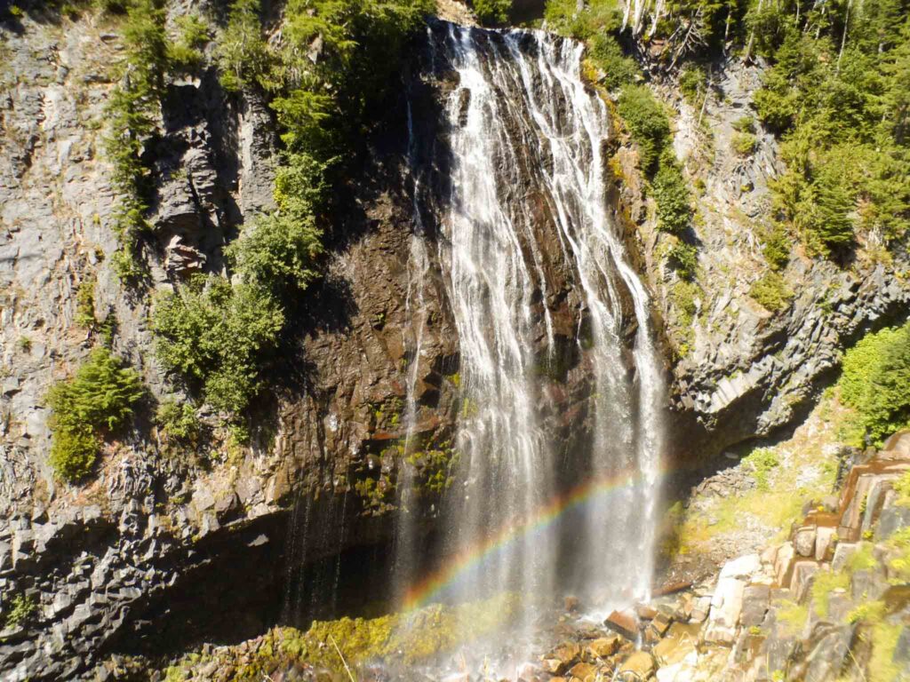
Narada Falls
– Location: Mount Rainier National Park
– Nearest City: Ashford
– Best Time to Hike: Summer
– Distance: 0.2 miles
– Required Pass: America the Beautiful
A slightly longer adventure than Christine Falls, Narada Falls is a natural wonder known for its signature rainbow on sunny days.
On wet and cold days, this trail gets slippery. Microspikes and snowshoes are great tools to consider for anyone not visiting during summer!
Mount Rainier National Park is home to many waterfall wonders. But the catching a glimpse of the rainbow on a sunny day earns Narada Falls a spot on the best hikes in Washington.
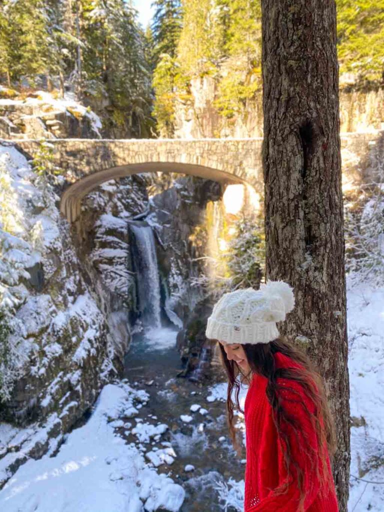
Marymere Falls
– Location: Olympic National Park
– Nearest City: Port Angeles
– Best Time to Hike: Spring
– Distance: 1.8 miles
– Required Pass: America the Beautiful
For those exploring Olympic National Park, I can’t think of a more magical place than Marymere Falls. There’s something about the way the water nestles into the vibrant, mossy rock that takes my breath away.
Luckily, the hike itself won’t! Many families frequent this trail. However, leave the pups at home as this is a national park trail.
Besides the waterfall, Marymere Falls trail is full of wondrous old growth trees. It’s worth taking this hike slowly, and appreciating the plants as well as the view.
While this hike is very busy during summer, if you go around sunrise or sunset you may have the trail to yourself. That being said, the waterfall experiences low-light during these times.
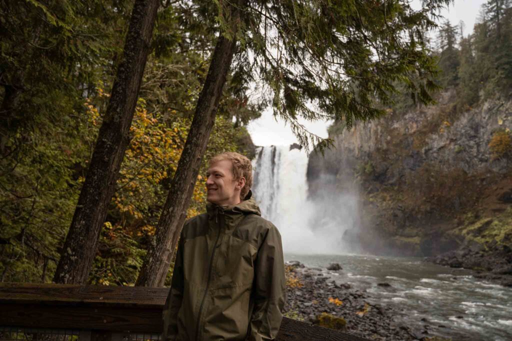
Snoqualmie Falls (Lower Viewpoint)
– Location: King County
– Nearest City: Snoqualmie
– Best Time to Hike: Fall
– Distance: 1.4 miles
– Required Pass: n/a
Quite possibly the most epic waterfall near Seattle, Snoqualmie Falls receives over 1.5 million visitors annually. Don’t let that dissuade you from visiting one of the best hikes in Washington!
Instead of a summertime visit, opt for fall. With fall foliage galore (and hardly anyone else on the trail) this is my favorite time to visit. Plus, during the wetter seasons the falls are known to be fuller. So you can see even more dramatic Snoqualmie Falls!
While you can see the falls from the upper viewing area, I recommend hiking down to the lower falls for another perspective. And, you’ll get sweet river views.
If you’re visiting from out of town or celebrating a special occasion, check out The Dining Room at The Salish Lodge. Here, you’ll get incredible Pacific Northwest cuisine and the chance to score a window seat with views of the falls. You’ll want to make a reservation ahead of time (even for weekday visits).
Visitors may park for free in the lot across from The Salish Lodge & Spa. Or if you have a Discover Pass, you can opt for the lot on SE Fish Hatchery Rd.
Shadow Lakes
– Location: Mount Rainier National Park
– Nearest City: Greenwater, Enumclaw
– Best Time to Hike: Summer
– Distance: 2.7 miles
– Required Pass: America the Beautiful
Of course, Mt. Rainier National Park is home to some of the best hikes in Washington State. The Sunrise area of the park has no shortage of trails worth trekking. But if you’re looking for an easy hike, then Shadow Lakes is your best bet.
In contrast to some of the more rocky, sun-exposed trails in the area, Shadow Lakes is a friendly place for those seeking alpine lakes, wildflowers, and shade.
Since we have seen black bears here, please brush up on bear safety before hiking. Always respectfully give them space – even more so when there are cubs present.
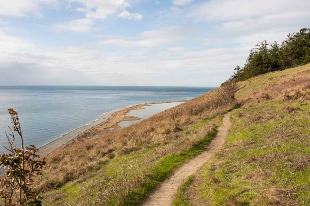
Ebey’s Landing
– Location: Whidbey Island
– Nearest City: Coupeville
– Best Time to Hike: Spring
– Distance: 3.6 miles
– Required Pass: Discover Pass
Another amazing trail along the Strait of Juan De Fuca is Ebey’s Landing. Don’t tell the other trails, but this is my personal favorite of the best hikes in Washington.
Whether you prefer high bluff-top views or low shoreline views, this trail doesn’t disappoint.
There’s a few trailheads to begin from, though I recommend parking at the lower lot. This way, the route is a straightforward loop. To begin, you’ll climb up to the top of the bluff. Then, hike along the bluff until the trail descends to the beach. From there, it’s a rocky walk on the beach back to the trailhead.
In case you feel like extending your outing, follow signs for historic sites like Ebey Blockhouse, Jacob & Sarah Ebey’s House at the top of the bluff. (Or park at the upper lot and see these sights separately.)
On a clear day, the Cascade and Olympic Mountains add an additional layer of drama to the scene. By mid to late June, expect to see purple wildflowers along the trail.
While you can do this hike year-round, please avoid it after recent rainfall. A slippery trail and steep bluffs don’t mix well!!
Young Hill
– Location: San Juan Island
– Nearest City: Friday Harbor
– Best Time to Hike: Summer
– Distance: 1.6 miles
– Required Pass: n/a
Another one of the best hikes in Washington State is located on an island! For panoramic island views, Young Hill can’t be topped. This is the perfect place to read a book, enjoy a picnic, or practice mindfulness.
And if you, like me, love history, then making a detour to the Royal Cemetery on your way back down is well worth it. Keep an eye out for interpretive signs – including one about oak trees!
In case you’re looking to shorten the hike by a bit, you can park along W Valley Rd instead of in the English Camp parking lot.
Point Defiance Park
– Location: Tacoma
– Nearest City: Tacoma
– Best Time to Hike: Year Round
– Distance: Varies by trail
– Required Pass: n/a
With 15 miles of forested dirt paths, tide- fluctuating shoreline, and the unique opportunity to walk on Five Mile Drive (a road that recently permanently closed to vehicles), there’s something for everyone at Point Defiance.
Located in Tacoma, Point Defiance Park is technically urban – although it honestly doesn’t feel like it. One of my favorite parts of the park is the Rhododendron Garden (peak bloom is in between May and June).
You’ll likely see deer, harbor seals, and ospreys. Please remember to Keep Wildlife Wild by keeping a respectful distance and not sharing your food.
Heybrook Lookout
– Location: Central Cascades – Highway 2
– Nearest City: Index
– Best Time to Hike: Winter, Spring
– Distance: 2.6 miles, 850 ft elevation gain
– Required Pass: n/a
A short hike up to a gorgeous fire lookout that stands tall above the surrounding trees. Winter and spring are our favorite times to hike this trail. Standing at a relatively low 1700 ft, the lookout does not get too much snow, and the tree canopy will shelter most of the trail like a snow umbrella.
We have done this hike in the rain, and it is a fun way to enjoy this trail. (Although, the trail becomes more of a stream!!)
A usually popular easy hike turns into a trail you get all to yourself! Just wear a good rain jacket, rain pants, and waterproof boots. I remember hiking down the trail and it was like a river flowing down the trail because it was raining so hard. The trail is armored well with rocks and good drainage, so it handles the flow well. It is sort of empowering hiking a trail in the rain and not being cold and wet. That is why it is so important to have good waterproof gear if you want to try this, or any hike, in the rain.

Heybrook Ridge
– Location: Central Cascades – Highway 2
– Nearest City: Index
– Best Time to Hike: Winter, Spring
– Distance: 3.3 miles, 775 ft elevation gain
– Required Pass: n/a
A similar hike and similar view to the nearby Heybrook Lookout, but less people. So, if you are looking for a peaceful hike, not too strenuous, and still has great views of the valley and across to Bridal Veil Falls, give the ridge a try.
We took our dog here, and it was a great choice because you don’t have to worry about passing as many people as you would at Heybrook Lookout. Hands down, one of the best hikes in Washington with pups.
Personally, winter and spring are my preferred times to visit because the mountains are snow-covered!
Sage Hills
– Location: Central Washington
– Nearest City: Wenatchee
– Best Time to Hike: Spring
– Distance: Varies by trail
– Required Pass: n/a
There are many ways to explore the Sage Hills in Wenatchee. With multiple trailheads just outside of town, it is a local’s favorite for an evening run, an afternoon hike with their dog, a morning mountain bike ride, and everything in between.
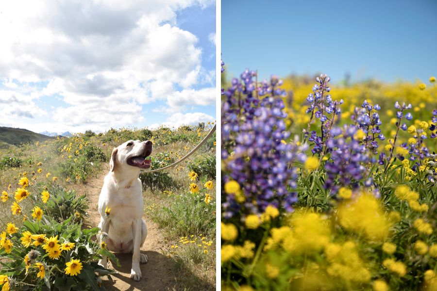
A two and a half mile dirt road drive up Horse Lake Road takes you to Horse Lake Trailhead and this is where I have always started my hikes. From here, you are already immersed in the beautiful yellows and purples of the springtime bloom and have incredible views of the snow-capped peaks of the Cascade Mountains.
Usually, we aim to visit around mid-May to see the lovely yellow arrowleaf balsamroot and purple lupine.
Bestie Tip: In the summer it can be very HOT mid-day and the trails have no shade unless you hike up over 1000 feet (roughly 3 miles) to the treeline. So, if you plan to hike in the summer, I would recommend getting an early start.
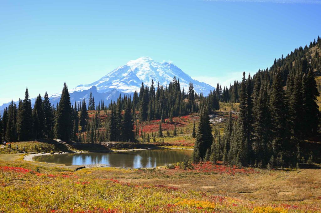
Naches Peak Loop
– Location: Chinook Pass
– Nearest City: Naches (52 miles), Enumclaw (45 miles)
– Best Time to Hike: Summer, Fall
– Distance: 3.2 miles, 600 ft elevation gain
– Required Pass: Northwest Forest Pass
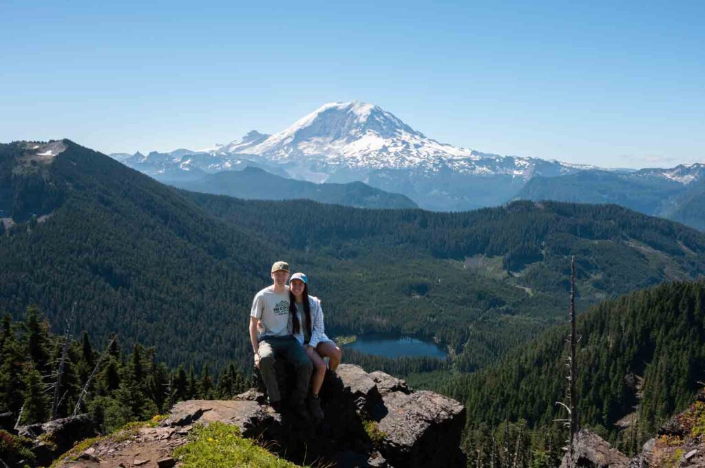
Who doesn’t love a loop hike? How about a loop hike with fresh epic views around every corner! That’s right, Naches Peak Loop trail offers sublime sights of Mount Rainier, multiple lakes, Mount Adams on a clear day, and chances to see wildlife like mountain goats. All in just a little 3.2 mile, 600 ft gain bundle. Lovely.
Personally, visiting during the fall is my favorite. I think the photo speaks for itself, right? With the red, orange, and yellow hues it is hard to argue that Naches Peak Loop isn’t one of the best hikes in Washington State.
Garfield Ledges
– Location: Mount Baker-Snoqualmie National Forest
– Nearest City: North Bend
– Best Time to Hike: Year Round
– Distance: 2.2 miles roundtrip & 830′ elevation gain
– Required Pass: National Forest / America the Beautiful
As one of the newest hikes in Washington, you may not have heard of Garfield Ledges. It was established in 2019.
Why do I keep hiking this trail? To feel on top of the world.
At the top (or “ledge”), the vista opens up to a birds-eye view of the valley below. You’ll see the Taylor and the Middle Fork Snoqualmie rivers wind, the bigleaf maple trees change colors in the fall, and be surrounded by the impressive yet comforting cascade mountains.
If someone asked me which trail they should hike for their first hike ever, this Garfield Ledges would be top of mind. Because of its close proximity to Seattle, low difficulty, and dramatic views, opting for this trail as a beginner hiker (or with kids) is wise. That being said, you’ll need to keep dogs leashed at the top and kids close to you as there is a drop off over the ledge.
Although we have not seen black bears on the Garfield Ledges trail, we did see one in the area while driving. So, brush up on bear safety before you leave home. This includes knowing what to do if you see a bear, how far to stay away, and packing bear spray just in case.
Bestie Tip: Rough road. The main spot you should exercise extra caution is heading over the bridge just before the trailhead. It is notorious for significant potholes. To avoid this, some cars park next to the bridge and walk over it.
Dungeness Spit Lighthouse
– Location: Dungeness Wildlife Refuge
– Nearest City: Sequim
– Best Time to Hike: Summer
– Distance: 10 miles +
– Required Pass: America the Beautiful
If you agree with the statement “A little wind never hurt anyone,” then the challenge of hiking over 10 miles on the Dungeness Spit may be an adventure for you.
Often, many well-loved best hikes in Washington like the Hall of Mosses or Marymere Falls get all the attention on the Olympic Peninsula. However, don’t miss the Easternmost area.
In particular, Sequim. Here, the Dungeness National Wildlife Refuge offers those up for hiking down to its beaches a chance to spot wildlife, be awed by the Olympic Mountains, and gaze out at bright blue saltwater.
Located on the Strait of Juan De Fuca, the most notable feature is the Dungeness Spit. This arced piece of land jets nearly 6 miles out into the water. At the tip, you’ll find the New Dungeness Light Station (Recognized as a National Historic Site). As a reward for your trek, you can even tour the lighthouse between 9 am and 5 pm everyday. No additional fees for entrance.
A few things to keep in mind:
- Tide charts: Since this is a lengthy hike on uneven terrain, it’s best to hike during low tide.
- Weather: It’s not uncommon for strong winds to be present.
- Which areas are open to the public
- Gear: Windbreaker, Waterproof Hiking Boots, Sun Protection
- Daily entrance fee: $3 (pay by check or cash in-person)
Curious about current conditions? Check webcams.
Franklin Falls
– Location: Mount Baker-Snoqualmie National Forest
– Nearest City: North Bend
– Best Time to Hike: Summer, Winter
– Distance: 2 miles
– Required Pass: National Forest Pass / America the Beautiful
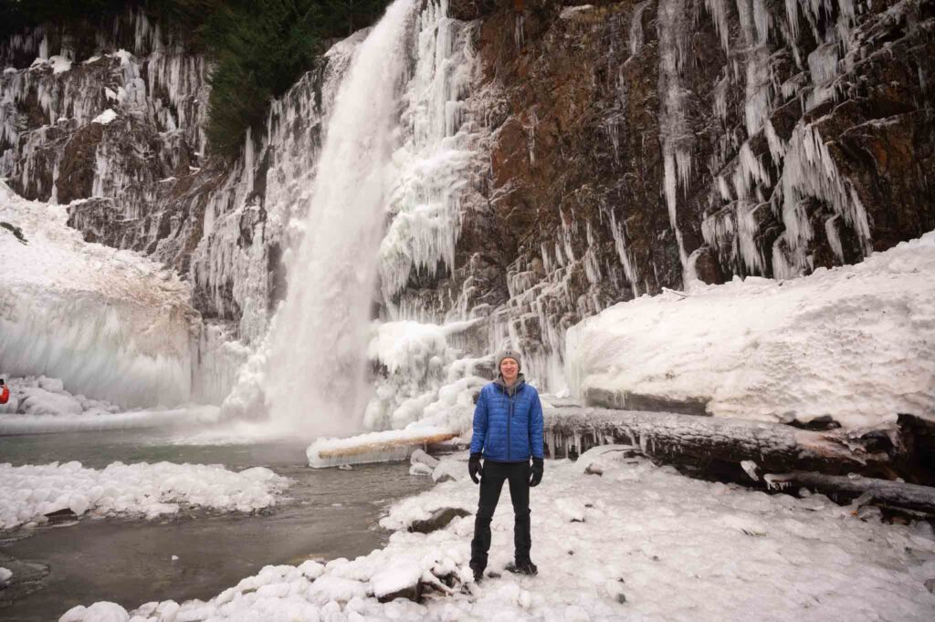
If you’re into winter hiking/snowshoeing, then chances are you’ve heard of Franklin Falls. At the very least, you’ve probably seen photos of its icy wonder. However, since the hike nearly doubles in length during this time of year (due to a road closure) it’s ideal to visit during summer.
Regardless of season, the trail treats hikers to old growth forest as well as views of emerald Denny Creek below. Elevation gain is gentle.
Personally, the only part of this trail that makes me nervous is the final descent to the shores of the creek and waterfall. It’s quite narrow and rocky, so personally I would not feel comfortable bringing my pup here (though many others do).
Silver Falls
– Location: Mount Rainier National Park – Ohanapecosh
– Nearest City: Packwood
– Best Time to Hike: Fall
– Distance: 2.7 miles
– Required Pass: America the Beautiful
Mt. Rainier National Park (MRNP) is a hiking hub for some of the most popular trails in Washington – for good reason. In total, it’s estimated that the park features 150 waterfalls! So, let’s get chasing.
Located near the Ohanapecosh entrance, Silver Falls is as refreshing as they come. It’s nestled in a vivid canyon surrounded by some old growth trees. You’ll likely encounter campers here. This is because the trail starts from within the Ohanapecosh campground.
Personally, I’ve found parking to be limited. So if you’re looking to stay a few days in MRNP, it’s worth checking out this more-often-overlooked area (compared to Paradise and Sunrise). While there, look around Ohanapecosh for more of the best hiking in Washington State.
Bench and Snow Lakes
– Location: Mount Rainier National Park – Ohanapecosh
– Nearest City: Packwood
– Best Time to Hike: Fall, Summer
– Distance: 2.5 miles
– Required Pass: America the Beautiful
Equally as stunning are Bench and Snow Lakes. If a sunrise or perhaps mid-day picnic at Reflection Lake is on your itinerary, consider exploring the Tatoosh Range.
Since the Tatoosh are mountains, after all, most of the hikes in the area can be quite steep. However with 700’ elevation gain, the Bench and Snow Lakes Trail is one of the most manageable – and rewarding!!
On this trail, get a taste for the beautiful backcountry. See alpine lakes, wildflowers, and views of the Mountain herself.
To cool down, many hikers take a dip in the chilly snow-melt water. Be sure to prepare yourself for low temps. Also, be ready for bugs (especially near the lakes).
Considering snow on the trail is important, so visit between late July and mid-September.
Blue Lake Trail
– Location: North Cascades National Park
– Nearest City: Mazama (20 miles)
– Must-Know Notes: Larches, usually in early October
– Best Time to Hike: Summer, Early Fall
– Distance: 4.4 miles, 1,050 ft elevation gain
– Required Pass: Northwest Forest Pass
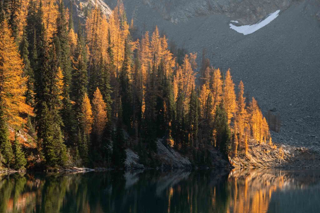
Hike to an unbelivably blue lake in the North Cascades. Of the best hikes in Washington, this one checked a lot of boxes for me. Larches turning bright yellow in Fall, check. Beautiful alpine lake to admire at the top, check. Hike under five miles so it won’t take up too much of the day, check.
For most, the drive out to the North Cascades is a big time commitment in itself, so finding a hike like this can be a great option rather than some of the other, longer larch hikes in the area.
Dege Peak
– Location: Mount Rainier National Park – Ohanapecosh
– Nearest City: Packwood
– Best Time to Hike: July to Mid-September
– Distance: 4 miles, 600 ft elevation gain
– Required Pass: America the Beautiful
Looking for a hike in the Sunrise area with amazing views but won’t take up the whole day? Dege peak is a great choice.
This hike takes you up along Sourdough Ridge heading east, away from the mountain. But, don’t worry, this hike has great views. From the top you are rewarded with 360 degree views of Tahoma and the surrounding mountains and valleys.
This is a good wildlife viewing trail as well. Mountain goats are commonly seen on this trail, and watch out for herds of elk in the grassy valleys.
Rattlesnake Ledge
– Location: King County
– Nearest City: North Bend
– Must-Know Notes: Exposed cliff; use caution
– Best Time to Hike: Winter
– Distance: 4 miles, 1,160 ft elevation gain
– Required Pass: n/a
This is one of, if not the most, popular hike in this area. However, it is popular for good reason. I’m sure if you asked any Washington hiker what the best hikes in Washington are Rattlesnake Ledge would come to mind.
The hike begins at the lake, which is a great day use area in the summertime and popular for paddling. Pick up the trail on the opposite side of the lake from the parking lot, and wrap up, around, and switchback to get to the ledge.
The ledge has an incredible view overlooking the lake, and of the surrounding mountains. In the summer the lake is bright and glowing. There are a couple spots up here where you’ll want to be very careful. Some of the rocks have large crevices you could fall in, and it is a sheer drop off of this ledge.
Twin Falls
– Location: King County
– Nearest City: Snoqualmie
– Best Time to Hike: Year Round
– Distance: 2.6 miles, 500 ft elevation gain
– Required Pass: Discvoer Pass
Follow the South Fork Snoqualmie River to this iconic waterfall. Check out the bridge above the falls for a unique perspective overlooking the valley downriver. Be sure to wander out the wooden stairway to the overlook of the waterfall, and check it out from the river below. But, be careful climbing over and on slippery rocks.
Little Si
– Location: King County
– Nearest City: North Bend
– Best Time to Hike: Year Round
– Distance: 3.7 miles, 1,300 ft elevation gain
– Required Pass: Discvoer Pass
What’s the opposite of Little Si? Big Si, because you’ll be taking a big sigh of relief when you realize you’re only doing half the distance and less than half the elevation of the neighboring Mount Si.
Little Si offers surprisingly nice views from the top. The hike takes you past climbing routes, so look up and over at the steep rocks as you walk the valleys of this trail and you can see climbers doing what people with acrophobia will never do.
Tolmie Peak Fire Lookout
– Location: Mount Rainier National Park – Ohanapecosh
– Nearest City: Buckley (27 miles)
– Best Time to Hike: Summer
– Distance: 7.5 miles, 1,100 ft elevation gain
– Required Pass: America the Beautiful
Mount Rainier National Park’s fire lookouts are special and the rewarding views are memories that will last a lifetime. This one begins after the long gravel drive up Mowich Lake road- watch out for potholes and take the washboard sections slowly. This may be one of my favorite hikes in the park due to the beautiful view of the mountain with Eunice Lake from the lookout.
The hike begins alongside Mowich Lake and meanders relatively flat for a bit. You may be surprised when you hit some downhill on the way out, but follow the signs for the lookout and you will be fine. A few switchbacks bring you up to Eunice Lake, which is great to explore the shores of- but be alert for bugs and wasp nests. Last time we hiked here we overheard a group get stung. Also, look up and you can see the fire lookout you will soon climb up to.
Our first time hiking here it was a moody, foggy hike and when we arrived at the lake, visibility was slim. As we meandered to head up towards the lookout, a doe revealed out of the fog, and it was a magical experience. Even with conditions like that, it’s one of the best hikes in Washington.
From the lake, it is a steep ascent to the lookout, but worth every switchback. The wildflowers here are fun, too. At Tolmie Peak Fire Lookout, enjoy a lunch or snack, take some pictures, and look around. The views are insane.
Mt. Storm King
– Location: Olympic National Park -Lake Crescent
– Nearest City: Port Angeles
– Must-Know Notes: Rope climbs to the top, bring gardening gloves
– Best Time to Hike: Summer
– Distance: 4 miles, 2,100 ft gain
– Required Pass: America the Beautiful
Perhaps the best view you can get of Lake Crescent without being in an airplane is at the top of this hike. It is no easy task reaching the summit. The trail climbs steadily until you reach a point letting you know that it is the end of the maintained section of trail.
Beyond this point is not for those afraid of heights, as you wander cliff sides and will need to use ropes to assist you up and down the last section to the top. With the trail being so steep that you need to use the ropes, definitely remember to pack gloves because the ropes get super dusty in the summer as the soil dries out. You may even have to sit, scoot, and crouch out of the way as other groups pass by, so expect your clothes to get dirty as well.
The view at the top is incredible on a clear day. Be careful if it is crowded or windy and always remember, a photo is not worth someone’s life.
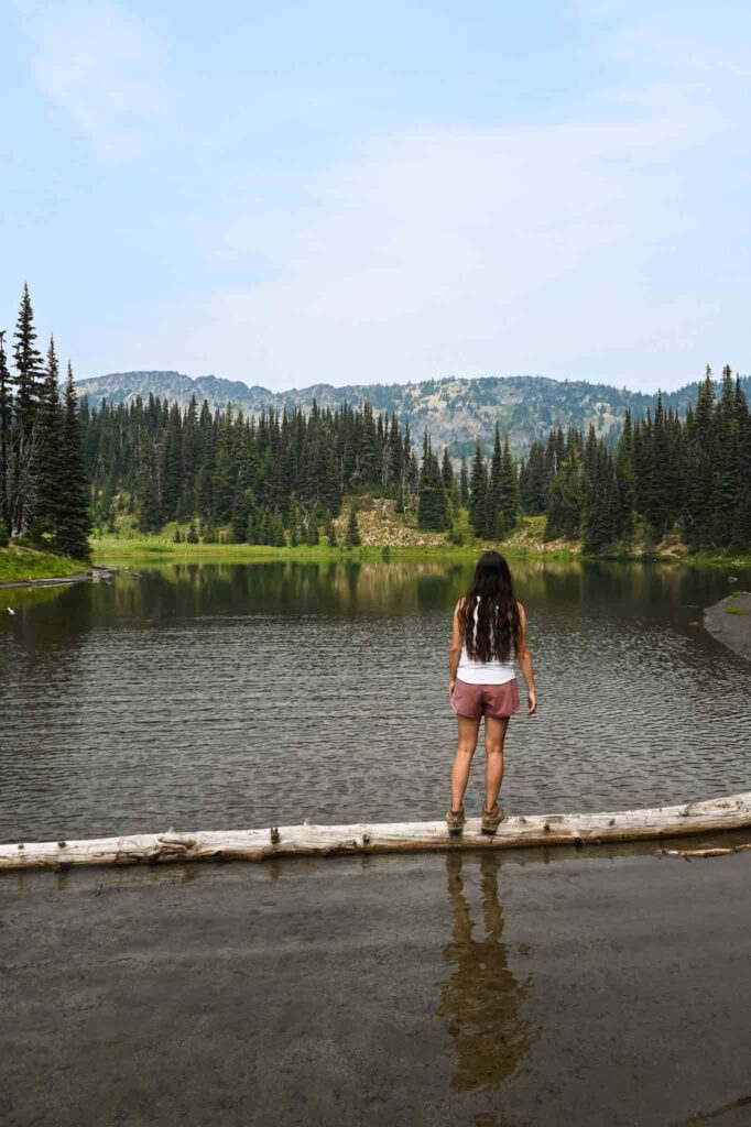
Summit Lake
– Location: Mount Rainier National Park – Carbon River
– Nearest City: Buckley
– Must-Know Notes: Rough road! High clearance vehicle recommended
– Best Time to Hike: Summer, Fall
– Distance: 6.1 miles, 1,300 ft gain
– Required Pass: Northwest Forest Pass
Royal blue water, clear Mount Rainier views, and all smiles is what comes to mind when thinking about a Summit Lake trail adventure. Some say the long rough gravel road is half of the adventure, but just take it slow and try to avoid the sharp rocks.
The hike itself is not too challenging, with the elevation gain being fairly gradual throughout the hike. The avalanche lilies are a treat to see along this trail in July. The lake freezes over in the winter and takes some time to melt out. We have gone in mid-July a couple different years and once did not experience any snow, and another the lake was still over half frozen!
Summit Lake trail gives Ebey’s Landing some tough competition for my favorite of the best hikes in Washington State.
Lake 22
– Location: Mountain Loop Highway
– Nearest City: Granite Falls
– Best Time to Hike: Winter, Summer
– Distance: 5.4 miles, 1,350 ft gain
– Required Pass: Northwest Forest Pass
A nice hike in the summer, but an arctic blast of a hike in the winter.. We did this hike in the winter and let me tell you, a frozen lake surrounded by snowy cliffs is something out of a storybook. When fully frozen, walking out over the lake is super dreamy.
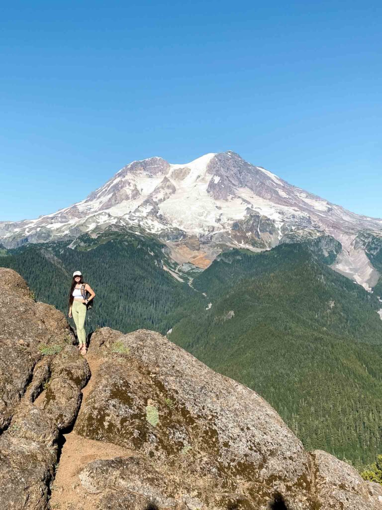
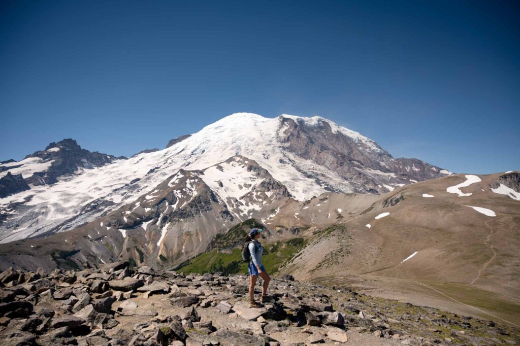
Skyline Loop Trail
– Location: Mount Rainier National Park – Paradise
– Nearest City: Ashford
– Best Time to Hike: Summer, Fall
– Distance: 5.5 miles, 1,450 ft gain
– Required Pass: America the Beautiful
Only have one day at Mount Rainier and want to experience some of the best views the park has to offer? Look no further than Skyline Loop Trail. This trail could be considered the most popular hike in the park, but for good reason. The hike begins at Paradise, with ample parking and a nice visitor center (with restrooms). Set up the paved trail towards Panorama Point.
Although paved, the trail wastes no time and gains elevation quickly right off the bat. The trail is steeeeep. But eventually mellows out a bit. And the views from up on Panorama Point are… you guessed it: panoramic! On a clear day you’ll be able to see the other prominent cascade peaks to the south. Mount Rainier is right in front of you the whole way up. It is breathtaking.
Continue around and this trail has a couple options of looping back down to the parking lot. It is well-signed with distances. Take your time, enjoy the views and you may even see some marmots and mountain goats. It would be hard to argue that this isn’t one of the best hikes in Washington!!
High Rock Lookout
– Location: Mount Rainier National Park – Ashford
– Nearest City: Ashford
– Must-Know Notes: Lookout tower is currently off-site being restored
– Best Time to Hike: Summer
– Distance: 3.2 miles, 1,365 ft gain
– Required Pass: Northwest Forest Pass
Short, but sweet trail up to an old fire lookout. And by sweet I mean steep, and you’ll likely break a sweat. At the top, the trail sort of ends and in front of you is just this steep rock. Climb it. Be careful of the cliffs and watch your footing.
Up top is the platform for the old lookout and in-your-face views of Mount Rainier. Now look around and find other mountains of the cascade range like Adams, Hood, and St. Helens.
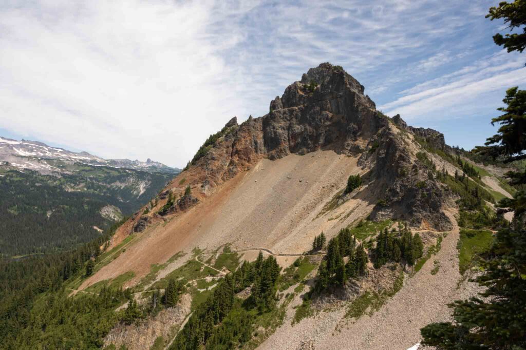
Pinnacle Peak
– Location: Mount Rainier National Park – Reflection Lakes
– Nearest City: Ashford
– Best Time to Hike: Summer
– Distance: 2.5 miles, 1,000 ft gain
– Required Pass: America the Beautiful
The hike up to Pinnacle Saddle begins from Reflection Lakes and takes you up into the Tatoosh Range. Although the Paradise area is highly regarded as home to some of the best hikes in Washington, the nearby Pinnacle Peak trail is lesser-known. With a limited number of parking spots at the start, this hike feels less crowded compared to the hikes that begin at Paradise.
Short hike, but pretty steep and steady climb. Once at the saddle, you have the option to continue up to the left or to the right. The views from the saddle and beyond are some of the greatest views of Rainier in the park. Along with that, you also get unobstructed sights to the south as well. Yay!
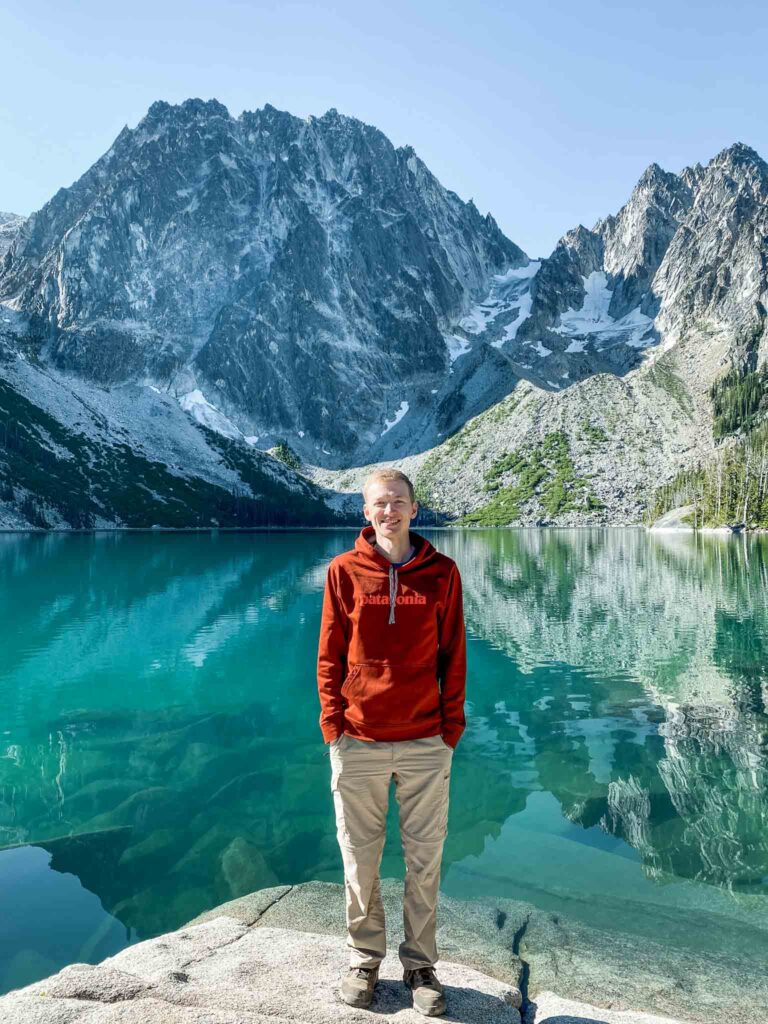
Colchuck Lake
– Location: Central Cascades
– Nearest City: Leavenworth
– Best Time to Hike: Summer
– Distance: 8 miles, 2,280 ft gain
– Required Pass: National Forest Pass
Catching the first sunlight hitting Colchuck Lake on a clear summer day is a moment I will never forget. Watching the lake change from a deep, dark blue to a crystal clear, aquamarine glow is incredible. Many people swim in the lake.
The parking lot is small for how many people set out on this trail, and it is not uncommon for the road to have parked cars for a mile. For this reason, many suggest getting to the hike by 6 am in busy summer months.
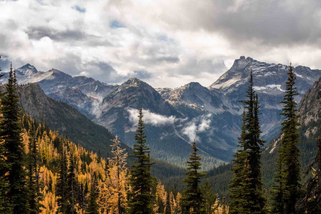
Cutthroat Pass
– Location: North Cascades
– Nearest City: Mazama
– Must-Know Notes: Late September/Early October Larches are golden yellow
– Best Time to Hike: Fall
– Distance: 10 miles, 2,000 ft gain
– Required Pass: National Forest Pass
If you time the season right (typically early October), at the top of the hike you will be walking through a bright yellow forest of larches. The trek up to the top of the pass is worth the journey, and you are rewarded with a panoramic view of the North Cascades. Surely, an unforgettable hike.
When we hiked this trail, we not only had amazing fall colors, but it also started snowing when we were at the top! Needless to say, Cutthroat Pass trail is undoubtedly one of the best hikes in Washington – especially during fall.
Gobbler’s Knob Fire Lookout
– Location: Mount Rainier National Park – Westside Road
– Nearest City: Ashford
– Best Time to Hike: Summer
– Distance: 11 miles, 2,565 ft gain
– Required Pass: America the Beautiful
Mount Rainier’s Westside Road takes you to a less frequented part of this national park. The hike is a unique opportunity because you are actually allowed to ride a bike up the Westside Road to the Lake George trailhead (about 3.8 miles), lock your bike up, and hike the trail to the lookout. The main advantage of doing so is that when you complete the hike and make it back to your bike, it is all downhill and you can coast back to the car.
The trail takes you past Lake George, which does allow overnight camping. The fire lookout is one of four within the park’s boundaries today. And, like the others, has unmatched views of Mount Rainier!
Mount Fremont Fire Lookout
– Location: Mount Rainier National Park – Sunrise
– Nearest City: Packwood (43 miles) or Enumclaw (53 miles)
– Best Time to Hike: July to Mid-September
– Distance: 5.6 miles, 1,200 ft elevation gain
– Required Pass: America the Beautiful
An epic fire lookout hike in Mount Rainier National Park. Use the restroom at Sunrise and then set off up the hill to Sourdough Ridge. The trails in this area are well-marked, so you shouldn’t have trouble finding your way. Continue to Frozen Lake, the source of Sunrise’s drinking water, and then hang to the right at the intersection and you’ll be up on your way to the lookout.
This is a popular trail during the summer when the Sunrise area is open. Be mindful of others and yield to the uphill hiker when you can. There isn’t much shade on this hike so be sure to bring enough water. Also, I would recommend sturdy boots because much of this hike closer to the lookout is over large loose rocks that may shift as you hike so it is nice to have the extra toe protection.
The reward at the lookout is amazing views of the mountain and to the north.
Burroughs Mountain Trail
– Location: Mount Rainier National Park – Sunrise
– Nearest City: Packwood (43 miles) or Enumclaw (53 miles)
– Best Time to Hike: July to Mid-September
– Distance: 9 miles, 2,500 ft elevation gain
– Required Pass: America the Beautiful
An impressive hike on its own, but an epic 10+ mile day hike if combined with Mount Fremont lookout! Hiking up to the Burroughs requires some steep climbs, but at the top it feels like you can reach out and touch Mount Rainier. Instead of heading to the right at Frozen Lake and heading towards the fire lookout, take a left (even though it’s the steepest option) and this will take you to the burroughs.
While we usually are satisfied and stop at the second burrough, there are three total, with each getting closer and closer to the mountain. This is a fun area because there are different routes to extend or loop your hike back to the parking lot so you do not need to go back the way you came. Last time we hiked here, a herd of mountain goats graced the area. On our return route to the parking lot, we took our route past Shadow Lake, where we encountered a mama black bear and her cub!
This post was all about the best hikes in Washington State.